Finding Sabang
- Mark Forsdike
- Dec 18, 2022
- 2 min read
Updated: Dec 22, 2022
I’m now delving deep into the history of the Far East campaign of Second Suffolk and I’ve come up against what seems to be a regular occurrence with researchers - Maps. The War Diaries have very little and having done a few Google searches, it appears that other have had the same problem.
I’ve reached May 1944 when Guerilla Platoon patrols were at their height and I’m struggling to find the location of one small village north of Imphal called ‘Sabang’.
From reading the Regimental History, it recalls that a patrol was mounted on 7 May by Captain Lee Hunter against the village, that ultimately led to Lee Hunter winning a Bar to his Military Cross Lance Corporal Peck winning an Military Medal, but finding the village is proving somewhat difficult!
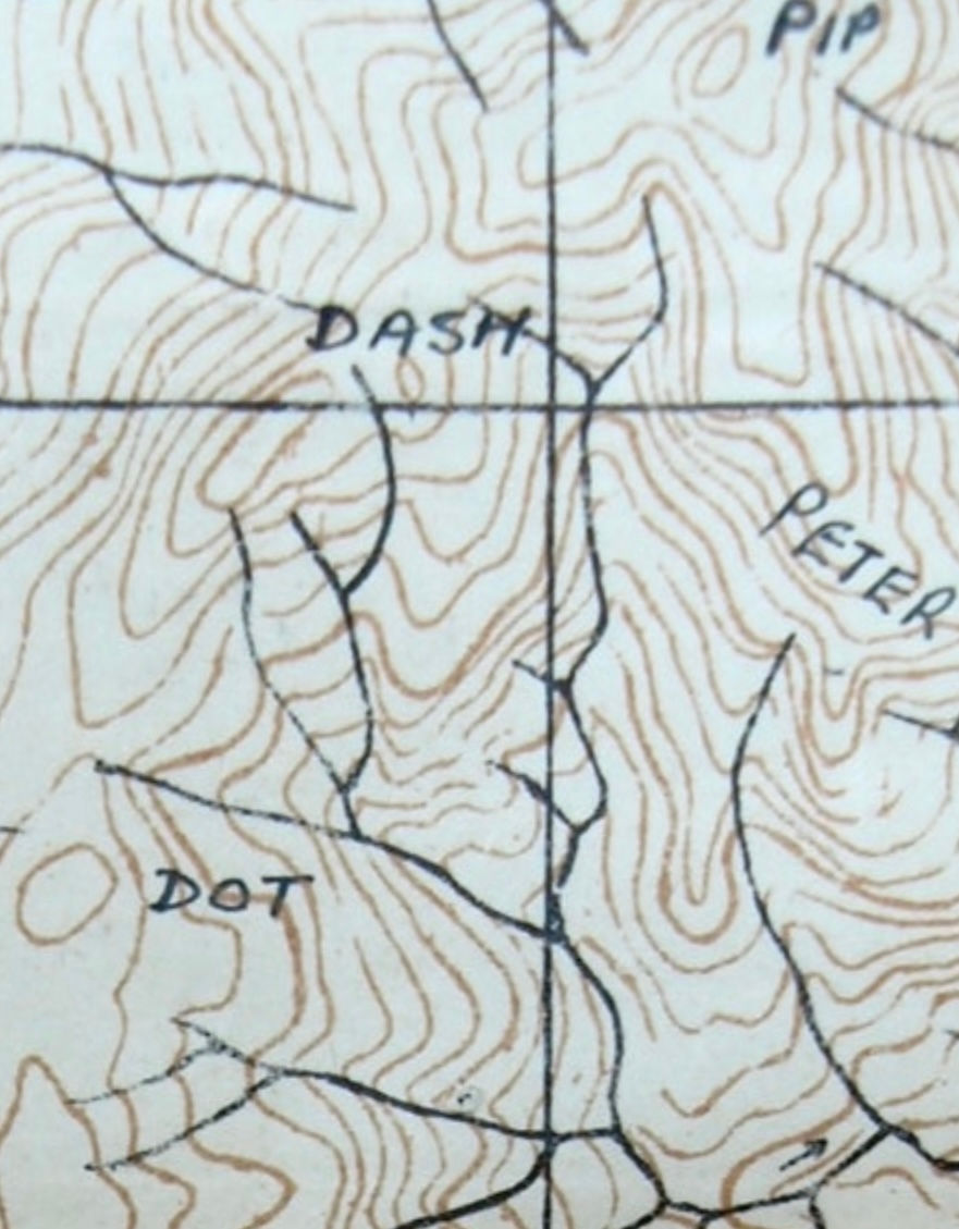
From looking at the map printed in the Regimental History, it shows the village as being north of ‘Isaac’ - a hill they were to take a month later, but the map is nothing more than a general sketch (and a pretty bad one at that!) and looking in both the Divisional History and at other period maps from that time, no village named as such can be found in that area.
Another issue I have noticed is that the War Diary narrative for the action calls the village ‘Sedang’ and not ‘Sabang’ as written in the Regimental History, so which is it?
I am inclined to go with the War Diary - having been written closer to the actual event than the Regimental History, which written some two years afterwards (and by someone who was not there), but even so, I still can’t find it on the map.
The maps of the day are sketchy to say the least, many being nothing more that contour lines, mapped some twenty years before by Goverment Agents. If a settlement was shown, often it had a double name or an westernised spelling of the native original and so both names often appeared side by side on the map for the same village (such as Ekban/Ekwan). Roads and rivers were all but feint lines. Tracks and paths were not shown at all. Heights were key when it was all a mass of vegetation and you were looking to locate yourself by the highest feature you could see nearby.
There is of course the possibility that the village doesn’t exist at all and that it was called by another name on the maps of the day, but even so, I find it unlikely that it would not appear somewhere. Another possibility to find its original location is that a height is given in the War Diary as ‘5086’ so it could possibly be only a small village that sprung up on a high hill that was previously unrecorded (settlements did move) and then it subsequently moved on again. The Regimental History places it north of ‘Isaac’ but here, all the highest features were given specific names (‘Dot’, ‘Dash’, 'Pip', 'Squeek', ‘Everest’ etc.) and I find it unlikely that one of these would not be referenced in the War Diary as these names were already in common use at the time.
Could it be a simple translation error? Could ‘Sabang’ be ‘Ekwan’ in Suffolk dialect, they do sound a bit similar? The search continues…


Comments